Visisting eastern zone of Collserola
1. Things to Know Before Starting the Hike:
- It is a trail that may have steep slopes and uneven terrain; a minimum level of fitness and appropriate gear is required.
- It may take around 2-3 hours to complete the route.
- It can be done year-round, although summers can be very hot, so it is best to avoid the central hours of the day during this season.
- It is recommended to bring water.
- Allow enough time to avoid finishing after dark. We recommend going in the morning.
- The emergency phone number is 112.
- In these areas of Collserola, many people are walking, running, and cycling… It is a safe place, although basic safety measures should always be taken.
- In this blog, we assume that the user has knowledge of how to navigate a mountain environment. We are not responsible for accidents or issues caused by recklessness.
2. The Hike
Distance: 2.87 km (1.78 miles) Elevation gain: 125 m. (410 feet)
Download GPX of the route
Start point: 41.45330195682832, 2.1710087273010097
End point: 41.443864138527594, 2.16192114475344
3. Arriving at the beginning of the trail
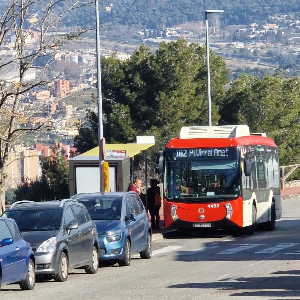
You can use different means of transport to reach the eastern end of Collserola. One option is to take the metro, green line L3, to Canyelles and walk to the 182 bus stop near Karl Marx Square.
Then take bus 182 to the Torre Baró – Castellví stop, which is very close to the starting point of the «Passeig de les Aigües» trail that runs across Collserola from end to end.
🚌 Parada 2728 – Plaza Karl Marx (Bus 182)
🚌 Parada 3113 – Glorieta Torre Baró Castellví (Bus 182)
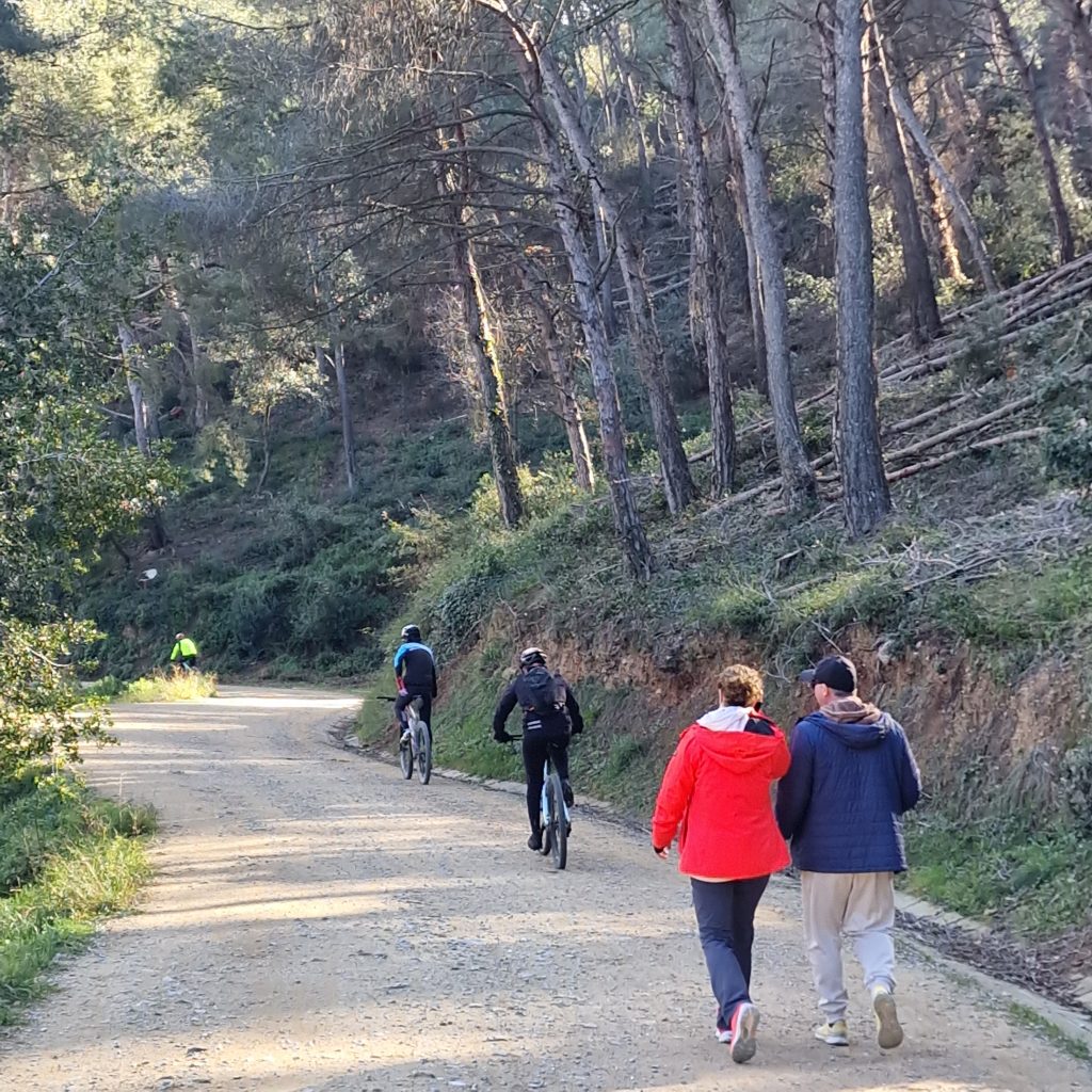
Very close to the bus stop begins the trail that runs through the entire Collserola from end to end, this path is called «Passeig de les Aigües». It is a wide path, in very good condition, used by hikers of all ages, runners, and cyclists to enjoy fresh air and take a walk. Motor vehicles are not allowed on this trail.
🚌 Parada 3113 – Glorieta Torre Baró Castellví (Bus 182)
🚶♂️🚵♂️ Start of the trail
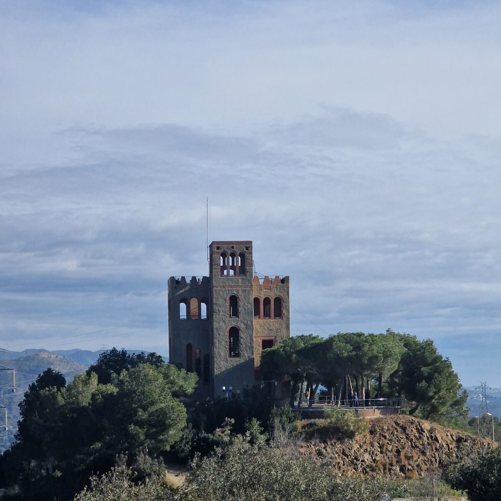
Before reaching the last bus stop, you will see the Torre Baró Castle on your right.
The History of Torre Baró Castle
Torre Baró Castle is a historical building located in the Nou Barris district of Barcelona. Despite its name, it was never a real castle but rather an unfinished project from the early 20th century.
The origins of Torre Baró date back to the 16th century, when a noble family known as the Baró family owned extensive lands in the area. The current structure, however, was built much later, around 1905, as part of an ambitious real estate project. The goal was to develop a luxury residential area in the Collserola hills, offering fresh air and scenic views away from the growing industrial city.
As part of this project, a grand hotel was planned to attract potential buyers. However, financial difficulties and lack of infrastructure led to the project’s abandonment, leaving the structure unfinished. Over the decades, Torre Baró became an iconic yet mysterious landmark, often associated with urban legends and local folklore.
In the late 20th century, the city of Barcelona took steps to preserve the building, and in 1989, it was restored as a public viewpoint. Today, it serves as an interpretation center, offering insights into the history of Nou Barris, Collserola, and the failed urbanization project that once aimed to transform the area.
Remember that it is the last stop of bus 182, and the driver will make you get off. Then, walk up the street, and you will reach the start of the hike.
4. The Trail:

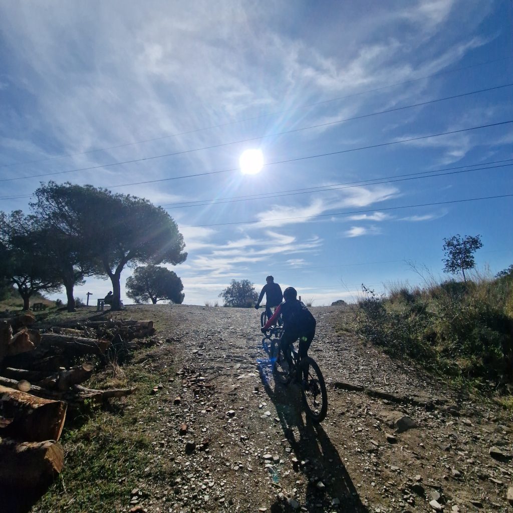
We can now start walking. The trail is closed to traffic and is frequently used by people walking, running, or cycling. Remember that pedestrians have the right of way.
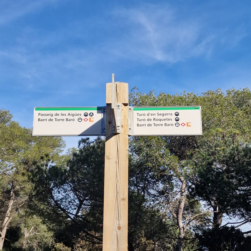
We follow the main trail for about 15 minutes until we see a turn to the left, which we must take. According to the sign, it leads to «Turó d’en Segarra, Turó de Roquetyes.»
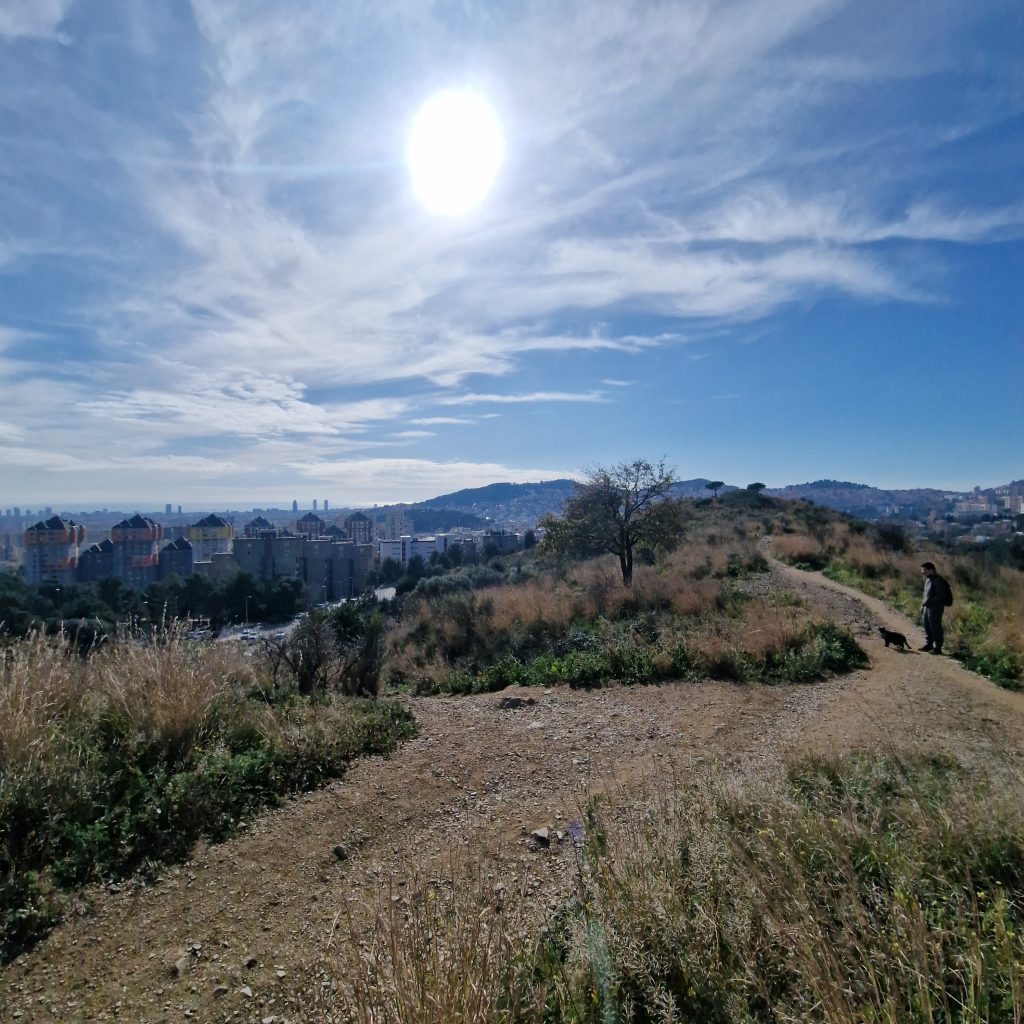
We continue for another 10 minutes and reach a mountain pass, where we can already enjoy the splendid views of Barcelona and find a bench to rest.
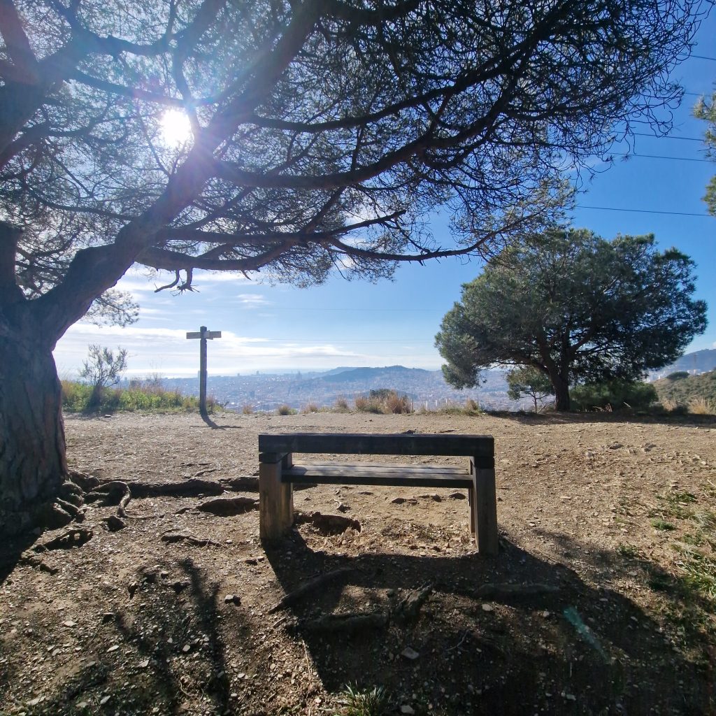
Once we have rested, we should continue westward, meaning that while facing Barcelona, the path will be to our right. We follow a wide track towards a hill with a large antenna at its summit.
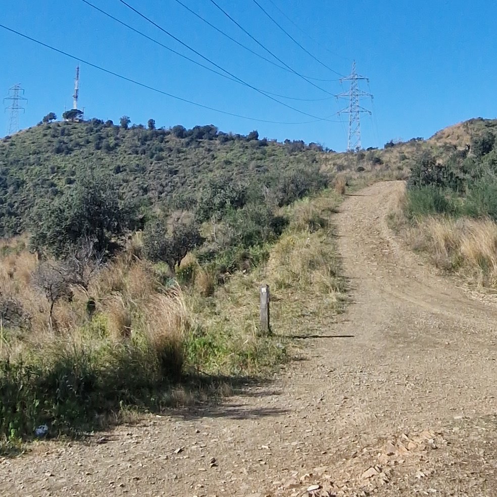
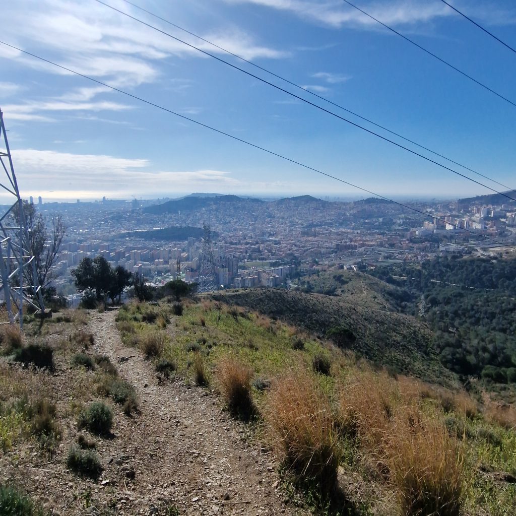
Once at the summit, we can enjoy the magnificent views of Barcelona spread out at our feet.
We can also see the descent path, which starts next to an electric tower. This section of the trail is narrow, steep, and has uneven terrain. For this part, it is important to have a certain level of fitness and experience walking in mountain environments.
We must descend towards Barcelona with caution.
We will continue descending until we reach a trail junction, where we should go straight ahead. Further down, when we are very close to the road, we will find another junction—this time, we take the left path.
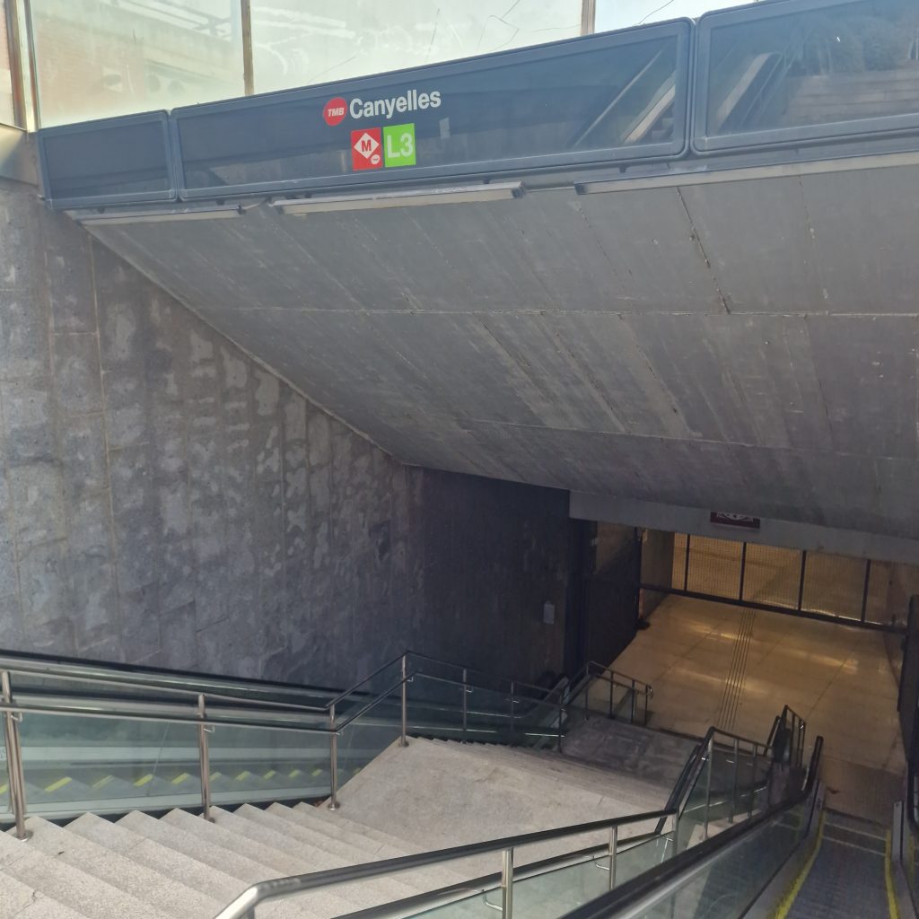
In about 300 meters, we reach the Canyelles neighborhood, where we can take the public transport that best suits our needs.
The L3 (green) metro station «Canyelles» is very close.
Have a great stay in Barcelona ❤️ Feel free to ask or comment.